I left the CF Motel rather late this morning: around 7 a.m. I knew I had a 33K walk ahead of me, and at a painfully slow 3 kph, that would mean arriving at the campground around 6 p.m., which is technically after sunset at this time of year. No hiker likes to set up camp in the dark, so for purely practical reasons, I resolved that, if I got within 10 km of my original destination and found another place to stay overnight, I'd choose that spot instead.
Lo and behold: I'd forgotten that, within 10K of the campground, there was a whole town across the river: Hanam-eup (하남읍). I used Naver to see whether this Hanam (not to be confused with the Hanam-si that sits right next to Seoul) had any yeogwans or motels, and it did, Cthulhu be praised.
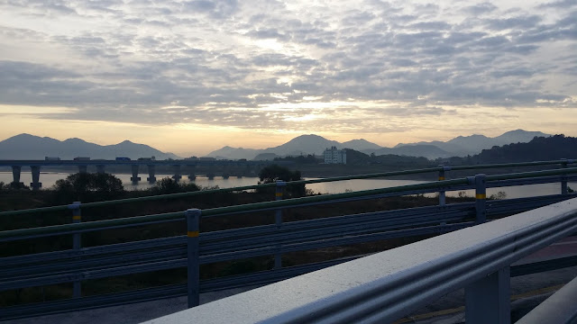
Where Naver went wrong, though, was in plotting a 5-kilometer course to reach Hanam-eup. Naver was telling me that I had to pass under one bridge, walk all the way to the next, cross the river, then double back to reach the motel-rich area. Fuck that, I thought, and I tromped up to the first bridge to see whether it had a sidewalk or some sort of painted bike path. And mirabile dictu, it had a raised sidewalk. So I saved myself a wasteful three kilometers by ignoring Naver and navigating old-school. Halfway across the bridge, I realized that Naver hadn't plotted a route across the first bridge because I had requested a biker's route, not a walker's route. And biker's routes are what I normally plot because, for whatever reason, Naver won't plot walking routes longer than 500 meters. Stupid Naver.
So I find myself in the sleepy little town of Hanam-eup. My yeogwan is the Haegeum-jang (what's with all the jang in yeogwan names?), a cheap and pube-y little shack of a place for W25,000 a night, but furnished with blazing-fast Wi-Fi. Ratty as the place is, it beats having to unroll my bivy and camp (I only just cleaned all my camping gear, after all). There are some shouty ajeossis outside my door right now; if they get drunk and even louder tonight, I'm going to be very pissed off. That's the one problem with cheap yeogwans: they attract low-grade people (like yours truly, apparently!). The yeogwan lady was friendly enough; humorously, she asked whether I wanted a razor to deal with my wild and scraggly beard. I laughed and told her I planned to shave it all off once my walk was over.
Today's walk was generally flat and, once again, beautiful. There was one steep hill, but it was short, so it was nothing to complain about. A few kilometers into the walk, I passed the last remaining dam along my route: the Changnyeong Haman Dam. I passed several campgrounds as well as some fishing spots; the trail sometimes put me on dedicated bike paths, and sometimes on the road along with the vehicle traffic. I had a decent enough shoulder to walk on, though, so I never felt in danger.
Because I stopped slightly early today, tomorrow's walk now goes from 19K to (gasp!) 19.5K. The next day's walk, to Yangsan, is about 18K, and then all that will remain is the final walk to the estuary: a 28K kick in the ass, marking the last time that I'll walk this route for at least another two years.
I view the imminent end of this walk with very mixed feelings. The trail is becoming like a friend to me, and the thought of not visiting it again for a long time is rather depressing, despite the hell that my feet have been going through. There are other trails to explore, of course, and I'm not against section-hiking chunks of trail in the near future. But I've started to think of the Four Rivers Gukto Jongju as my trail, not in the possessive sense that it belongs to me, but more in the sense that I belong to it. It's like when you say "my country" to evoke a sense of belonging. The Four Rivers: that's my trail.
Some pics from today appear below.
Leaving Namji-eup:
A few hours into my hike, I had to walk through a rough-looking crew of landscapers who were busy hacking away at various plants and foliage to keep the bike trail clear. One worker actually stepped into my path to catechize me about my tee shirt. He had all sorts of questions about where I started, where I was headed, how long my trip would take, and so on. At almost every turn, I had merely to point to my shirt to give the man the answers he wanted; the tee's design is pretty good, if I do say so myself. The rest of the crew listened to us talking while a pot of soup boiled away, off to the side. I complimented the whole crew on the hard work they were doing; another guy made the universal gesture for "coin" and joked, "We gotta make money!" Everyone laughed at that, and I was back on my way. I wish I had taken a picture of those men. A cheerfully motley crew, indeed.
Cosmos and cosmic turtles:
Hey, hay:
One of several parks:
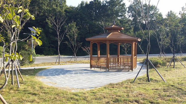
A modern but lonely-looking shwimteo:
I missed a turn in this neighborhood and wasted time sorting myself out. Here are some flowers next to a wall:
But is it a shwimteo?
No shortage of scenes like this:
With every glove, a story:
Changnyeong Haman Dam from a distance:
The dam as seen from its admin building:
Go forward or go back?
Crossing the dam:
Shwimteo with a weird, striped support pole, bottom center:
A heavily damaged bridge that was a bit scary to walk on:
Why you can't trust the milestones, #1:
Why you can't trust the milestones, #2:
The distance markers play with your heart and head. First, they're telling you it's only 85 km to the estuary, then they're telling you, a few kilometers later, that it's actually 89! Fuck these things. They're useless. Just rely on Naver.
This part of the trail is just past a convenience store billing itself as "The Last Convenience Store":
A glimpse across the way at a tiny hamlet:
About to cross a bridge into Changweon City:
Found while crossing the bridge: a tiny carving of the Heart Sutra, which I promptly pocketed with a Gollum-like croak of "Mine!" said to no one in particular:
I had to wonder why someone would throw a religious artifact away like that. I've never seen anything like this on the road before. My speculation didn't get much further than, "Maybe his girlfriend gave it to him, then they broke up." Broken-heart Sutra.
Another town, another Lions Club lion:
Wikipedia says the current president of Lions Club International is a Korean national: Dr. Choi Jung-yul.
The bridge across the Nakdong River to Hanam-eup, where I am now:
Getting closer...
And we end on a fine meal of dolsot bibimbap and son-kalguksu:
Photo essay:
Subscribe to:
Post Comments (Atom)
POPULAR POSTS
-
I was expecting to average 3 kph and arrive at around 4 p.m. Instead, here I am, and it's not even 1 p.m. Will sit here a bit, nurs...
-
Official total # of kilometers walked: 633 (approx. 393 mi.) Average daily distance walked (walking days only): approx. 26 km Total ste...
-
My Survival Tabs have arrived, although not in the form I suspected. I had thought I was going to get a large pack with tons of tablets in ...


What a great day with a very happy ending. Again, the camping days on the trip were the one part I couldn't imagine doing. That you've managed to avoid most them now is kismet indeed.
ReplyDeleteI was wondering about how you felt as your journey nears it's end. Interesting that despite the hardships and pain, you are experiencing some sadness. A true walking man! There will be new trails to conquer!