
Things got painful within an hour of walking. The morning started off cloudy, but the promise of a bright and sunny day was in the air, and by 8:00 a.m., the sky was gorgeous. Since I'd never walked this route before, I decided to document something near and dear to my heart: restrooms. Sometimes, if you zoom in close enough on the Naver Map app, you can see where rest facilities are, but Naver Map isn't always reliable about showing these, which is understandable, given that these facilities can be slapped up and taken down at the drop of a hat—much faster than the app's map would be updated.
Part of the walk's purpose was to do a self-assessment of my various aches and pains. For the most part, they boiled down to the following:
• achy feet, especially the right foot
• achy back, even after cinching my hip belt as tightly as I could
• burning neck, mainly thanks to friction from the pack's shoulder straps
• a sinister ache in my liver (upper-right abdomen)
I barely drank any water during my walk, so that was a burden: I had to carry that water on my back. I did discover, though, that the route has rest facilities almost every kilometer, so a person hearing the call of nature needn't worry too much about exploding before reaching a toilet. There might have been one restroom-free stretch that was slightly longer than a kilometer, but otherwise, restrooms could be found regularly, and except for two restrooms that I missed because I had to recharge my phone, I photographed pretty much all of them, and like it or not, that's part of the photo essay you'll see below.
It really was a gorgeous walk. The weather was almost perfect for just this sort of activity, although still a bit too hot for my taste. I felt bad about wimping out and training back to my place, but my feet were screaming, and I knew there was no way in hell that I'd make a round trip of 64,000 steps. Tomorrow, I'm going to just hike to about the 21,000-step limit, then turn around there, even if I'm still kilometers away from Jeongja Station. I'll gather all the data I need from doing that. There's no reason to tromp 60,000 steps yet.
I ended up leaving late—close to 6 a.m. for my start time. The sun was out. Finishing time was around 12:30 p.m., but I rested for a total of an hour—45 minutes at one point as I charged my phone, plus about 15-20 minutes at another. So I'd put my total walk time at around 5.5 hours. That's quite slow, even for me, but keep in mind that I was in some pain. I may visit the pharmacy and see about getting some ibuprofen, although I know that NSAID pain relievers, especially the stronger ones, will make you bleed out of some uncomfortable holes if you take large doses too frequently. I've also got orthotic insoles coming, so I'm hoping that rest, a bit of weight loss, ibuprofen, and those insoles will all work together to make the walk a bit less, shall we say, difficult.
As for the pains I mentioned above:
1. At a guess, the foot pain could be either rheumatoid arthritis or the simple fact that I'm overweight. This wasn't an issue two years ago, but I'm two years older, and that might be reason enough for it to have become an issue. I don't think the problem is fallen arches; I've already done the footprint test, and my wet footprint on a paper towel looks normal.
2. The achy back was a problem last time as well. Dealing with the pain requires a combination of cinching the hip belt tighter, periodically using my trekking pole to lift the pack up and off my shoulders for a few minutes, occasional resting, and simply bearing the pain. Unless I miraculously lose a hundred pounds, back problems are my new normal when distance walking. It does, however, make a huge difference whether I'm carrying a pack or not: I can go for hours with almost no back pain when I'm unencumbered.
3. The burning sensation in my neck was caused by friction leading to abrasion. Chalk it up to poor design by Gregory, the company that made my pack: the chest strap brings the shoulder straps closer together, but in doing so, the tops of the shoulder straps—which should have been set more widely apart—come in contact with my neck. The feeling was a lot like having a sunburn. Obvious solution: cover my neck with a towel before putting the pack on. Problem solved, I hope. I used towels on my 2017 trek; they came in very handy.
4. The liver situation is worrisome. While the reptilian part of my brain automatically starts screaming Liver cancer!, I'm thinking this is a symptom of fatty-liver disease, but I'd need to be checked professionally to be sure. I've experienced this ache on many previous walks and haven't talked about it, but today, the ache was hard to ignore. I kept imagining what would happen if I got punched in the liver. Not a pleasant thought. I may get an X-ray done after the walk. Here's hoping my liver doesn't burst like a water balloon before then.
Since I came back to my place, I decided to take advantage of my 2011-era MacBook Air laptop, which has Photoshop Elements on it. I've spent a lot of time resizing pics, reducing glare, doing a bit of cropping here and there, and I think I have the makings of a picture essay showing the route from my residence in Daecheong Tower, southeast Seoul, along the Tan Creek and all the way to Jeongja Station in Bundang. I'll upload all the images now, without explanations; come back to this post because captions/narrative will be tacked on later.
Warning: there are 89 images. All of them are clickable, but for the "landscape"-style images, click on them once, then right-click and select "open image in new tab" to see them full-size. If the images are already large enough for your taste, then... I have nothing more to say.
I took the following shot at around 6:10 a.m. This is the footbridge that lets me cross a highway and get on the Tan Creek trail. Breaking left leads to the Han River, and that's the way I go all the time. I rarely break right, which ultimately leads south to Bundang and beyond, but that's what I did this morning. So here are the footbridge and dawn, with Lotte World Tower in the distance:

The following shot is a bit disappointing. I was amused by the juxtaposition of a temple of Jesus and a temple of crass consumerism. The church and Lotte World Tower looked bigger in real life, but the damn camera shrinks everything down and trivializes whatever you're looking at. Anyway, the Two Towers, sort of:

I've been along this stretch of the Tan Creek trail before:

Am always fascinated by the iterative patterns underneath these big bridges:

First restroom along the trail! There will be many more:

It had rained the day before (Friday), but one creepy thing I noticed during this walk was the near-total absence of post-rain earthworms. Korean earthworms are huge—easily a foot long on average. Not a single one made an appearance, but I did see some wimpy little earthworms about two-thirds of the way through the Saturday walk. Have a look at the wet earth below, which wasn't wet for long: everything had dried up by late morning.
Oh, by the way, this footbridge is significant because you have no choice but to cross the creek here. There's no chance to cross back to the other side until you've gotten down the creek a ways—maybe after three hours' walking.

Lots of long, straight stretches like what you see in the pic below. I sometimes think the unnatural straightness makes this less a creek and more a canal:

Click the pic to enlarge and see what the sign says in English:

Another bridge in the distance. Tons of bridges today:

Another restroom, which was reassuring:

A purple flower that appeared along much of the path:

A wider shot so you can see how small such flowers are:

Sorry for the blurriness:

Flowers can be friends, too:

Choices, choices. The sign in the pic below tells me that going straight will lead me to Seongnam City, which is indeed where I'm headed:

The blue sign below tells me that Seongnam City is to the left. Go right, and that'll take you toward Seoul's Songpa district, Jamshil, and the Han River. The warning beneath the directions basically says that this is a path for both bikers and walkers, so exercise caution:

You can sort-of see it in the pic below, but look out, in the ensuing images, for evidence of how the Tan Creek massively overflowed during the recent typhoon and sundry storms. You'll see plenty of scrub and grass leaning drunkenly over because tons of water rushed by. Strangely, I didn't see any fish carcasses on the ground, far away from the creek. That happened to me once during a walk a couple years ago.

Very roughly, the stone below says: "Tan Creek: where people and nature exist in harmony." We won't ponder the irony that this expression of harmony is on a man-carved rock plopped by the wayside and having nothing whatsoever to do with the local geology:

It is my destiny to encounter plenty of illegal traffic on bike paths:

The sign for another restroom:

I didn't realize Kakao (the messaging-app company) also had a bike-rental service. Live and learn. Behold Kakao T Bike:

The aforementioned restroom, hidden way back:

Straight stretch, swooshy overpass:

See what I mean about drunkenly leaning vegetation?

On my other blog, we briefly discussed the Korean term jinggeom-dari, which refers to the stepping-stone bridges that are a feature of local watercourses. Here's one of several that I photographed:

This sign apparently points to another creek, the Segok:

Yet another long, straight stretch:

The stairs to mystery:

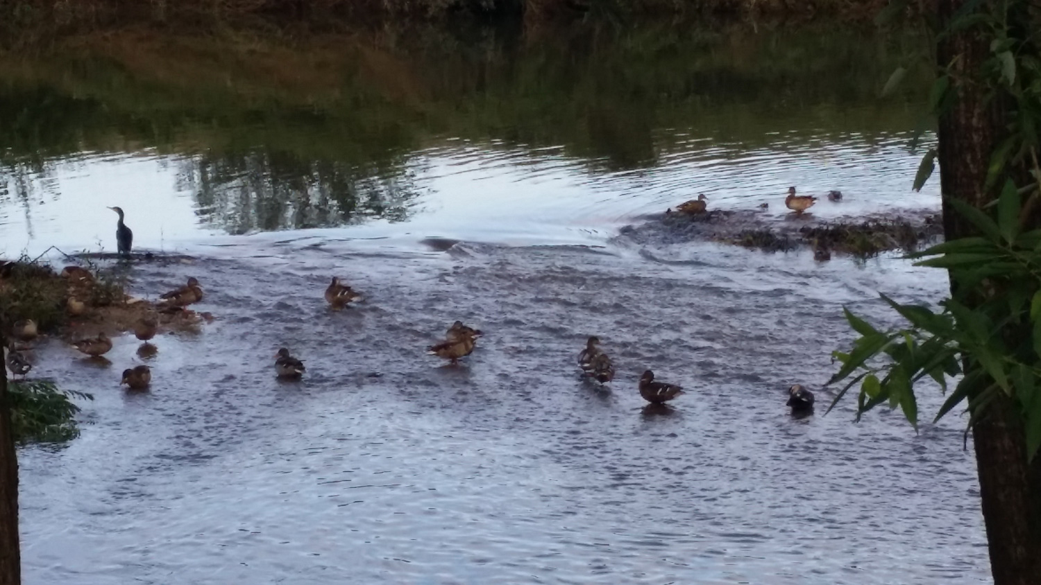
There were several duck dynasties on the creek, having their ducky little conventions. I was sorely tempted to video these birds (and I assume they're not all ducks). One had been standing there with its wings outstretched, almost as if there were some mating ritual going on. The bird (I mean the arrogant-looking one just north and left of center) folded its wings in right as I got the shot you see below. Fucking prude.

A second shot:
The following photo looks to be of some sort of military base or prison. I'm guessing it's a base: when I tried to find the area on Naver Map, that whole region defined by the wall, on the west side of the creek, was unlabeled. Loudspeaker announcements blared out at random moments, reinforcing the prison/base vibe, but I couldn't understand what was being said. Anyone with inside information is welcome to leave a comment.

Another restroom sign! The facilities are in the distance:

These solar panels apparently help to power some sort of lighting system that helps planes to navigate. The sign says that this is an "airplane-safety zone." There were long stretches of the path lined with much smaller solar panels; I don't know whether those panels had the same purpose or were there for a completely different reason. Panels:

Another restroom:

There were several empty swimming pools along the walk:

Here's a closer look:

Yet another restroom, not much farther along:

And its attendant sign:

At this point, the path curved left, but I had the choice of taking a little jinggeom-dari as a shortcut. I did so, and it was slow going on painful feet, but if you look very closely, you might barely see that the final two stones of the bridge are submerged, which didn't make my feet very happy:

Another restroom! Truly is this path blessed:

The long, straight stretch that defines your life:

One of the smaller solar panels mentioned earlier:

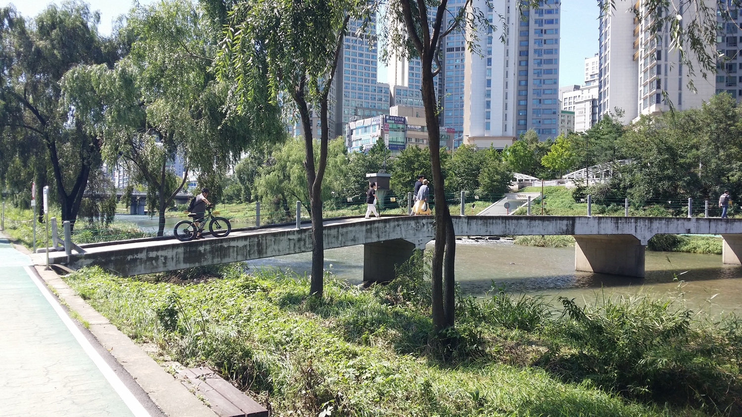
Another of many, many footbridges. Not all of them were walkable; some had chains and signs warning us away. I didn't look closely at the signs, but given what I know about the Yangjae Creek, these bridges are often closed to walkers during flood conditions:

There were several shwim-teo (rest areas) that had this sort of circus-tent-meets-parasol thing going on, so I thought I should snap a photo of at least one:

According to the sign, we've reached the end of the marshland ecological preserve:

A closeup of the sign:

And here was another stepping-stone shortcut, which I didn't resist:

A closer look:

Footbridge:

This is the Dunjeon Bridge (rhymes with "moon run"), as you see from the sign:

I snapped pics of many of the bridges I passed under. My phone stamps each photo with a filename that is essentially a date-and-time stamp. I can go back and look at those stamps, measure the bridges' distance from each other on Naver Map, and see roughly how fast I was walking.
Another restroom just past the Dunjeon Bridge:

Hypnotized by these long, straight stretches yet?

That's not really a footbridge; I assume it aids in aerating the water:

Drunkenly leaning plant life:

Groundskeepers had come by and made manageable piles of wood, post-flood:

Barely a kilometer later, another restroom! I wonder whether all these facilities were funded by some sort of bladder-and-colon society:

That to which the signs point:

A hospital:

Below, another empty pool. It's about 9:00 a.m. I've been walking for three hours. Normally, that would mean nine miles, but with my feet now pleading for mercy, I'd say this was a little more than eight. The dead pool:

A sweaty Kevin:

Noting that my phone's battery was low, I decided to rest here, beneath the shade of a bridge. Luckily, I had my phone's portable power pack with me, so I hooked my Samsung up to it and just lay on a bench—anything to get the weight of my body and my backpack off my feet. Around 9:30, I got up, wearily shrugged the pack back on, and shambled onward. The path forward was—and I think you know the refrain by now—a long, straight stretch:

Bridge:

A wide shot of Seongnam City and the Bundang area:

Seven kilometers to the Yongin city limits:

The bike path and walking path were often separated by a kind of flat median strip that often served as a park/activity space. There were occasional basketball courts; there was gym equipment (usually of the useless variety—spin the large wheel, swing back and forth for no reason, etc.); there were shaded and unshaded picnic areas. The entire walk was turning out to be nicely manicured and landscaped, and very beautiful overall. There was never a sense of being far away from civilization, but I don't think that evoking such a feeling was the goal of this area's designers. Instead, I'd say the goal was to strike a tasteful balance between and among the apartment and business buildings in the distance, the creek (or canal!) by one's side, and whatever plant life could be used to provide some relaxing greenery.
Seohyeon Bridge:

A nifty mosaic spiral:

Below: a dude. And another empty pool:

Another jinggeom-dari that's not an actual bridge:

Empty pool up close:

A nifty spiraling wall. Reminded me of an abstract cinnamon roll:

Restroom! And bathed in heavenly light:

My buddy Mike wants to know if the pic below is of a "fish ladder." Is it?

Sunae Bridge:

Hwang Saeul Bridge:

Bundang proper looms ever closer:

A still pic doesn't capture the loud, violent churning of the water here:

Funky architecture at a distance! Large train station? Convention center...?

Baekhyeon Bridge:

This upcoming bridge made me think of hamburgers:

The bridge is called Baekgung, which is Chinese for "White Castle."

Another fish ladder?

We're getting close to where I eventually stopped (Jeongja Station), but at this point, it was after 11 a.m., and I was having an internal debate about my pain levels and my realization that doubling back would mean a 60K-step day—not something my feet could tolerate.
A maze, with a foreshortened rabbit at the maze's entrance:

Gungnae Bridge:

Say it with me: a long, straight stretch...

Bundang/Seongnam City in all its fullness:

Below is a pic of the grungy little footbridge where I finally crossed back to the other side of the creek and made my way up to street level to hunt down Jeongja Station. I don't know what the Chinese characters for jeong and ja are in this case, but the word jeongja also happens to mean "sperm." So, yeah: Sperm Station. (No, not really, but still, I can't help thinking that Sperm Station is where all the lovely people come.)
One last, longing look at the beautiful creek and its environs:

And now we're at street level. Jeongja Station is down the street and across.

Final pic is of a wooden walkway.

That's an anticlimactic way to end this photo essay, I realize, but I hope you enjoyed this 32,000-step stroll from Seoul to Bundang. I enjoyed its beauty and will definitely be adding this route to my repertoire, especially now that I know there are restrooms all along the entire length of the walk. I only wish I hadn't been in so much pain, but I'm hoping that some ibuprofen and orthotic insoles will help with that problem.


In some of the photos you posted, ones of water crossings, there are wide "ramps" up along one side of the crossing. Are these "fish ladders" like I've seen in the US?
ReplyDeleteI really couldn't say. There certainly are a lot of fish in the local creeks and streams, so it's at least possible that those are fish ladders.
ReplyDeleteSorry to hear about the aches and pains. Kind of surprised the lighter backpack is still causing problems. Hope today's hike goes better.
ReplyDeleteThe funky architecture is Job World
ReplyDeleteThanks, Dan. But what is Job World? A convention center for job-seekers? I guess I'll look it up...
ReplyDelete